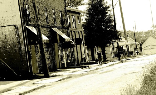
On the south end of downtown, close to Morris Street. I have included a link to this photo's location on google maps. There have been some requests to do this, so I will be including these on more of my shots.
I especially enjoy your photos in the areas around the Interstates -- gives a glimpse into the impact those highways really had on the oldest parts of town.
One day I want to make a tour of all the neighborhoods severed by the Interstates. (That is, once I screw together the courage, since some of those neighborhoods are awfully rough.) I'd love to find pre-Interstate photos to do a before-after comparison.

3 comments:
Thanks for the map link!
I especially enjoy your photos in the areas around the Interstates -- gives a glimpse into the impact those highways really had on the oldest parts of town.
This area was hit espescially hard; it has limited access highways on both its north and east sides.
One day I want to make a tour of all the neighborhoods severed by the Interstates. (That is, once I screw together the courage, since some of those neighborhoods are awfully rough.) I'd love to find pre-Interstate photos to do a before-after comparison.
Post a Comment